Friday, September 14, 2012

Crestline to Valyermo flight, 34 miles


Good forecast for 10K+ with east wind all day convinced me to take a day off. Usual suspects in our team, Rebar Dan, Jonathan and our driver Greg. Launched at 11:42 into a strong cycle, went straight up, barely penetrating forward. Go to Pine Mt. and climb to 9.4K right away
Flying high over Pine Mt.
10.9K near Cajon pass, easy crossing
Flying across Cajon pass
Jonathan passed me on the other side of the pass, taking more north route. I prefer to stay over small ridge along Long Pine Creek Rd. There is good trigger point before Wrightwood the only problem it's always turbulent and this time was not an exception. There was a shear line on certain altitude and wing was all over the place, luckily no collapses. After Wrightwood meet with Dan, he was in the same thermal, but lower.  11.3K altitude motivated me to start flying faster, so I did not top out in each thermal (mistake #1). Then I saw Jonathan over Devils Punchbowl Park climbing well and rushed there, but could not connect with his thermal. Get some altitude after low save, but was not sure I can jump safely to the back range and since terrain is rising I would arrive there low.
Devils Punchbowl Park
Instead I keep going over small ridge hoping to get another thermal (mistake #2), which put me to the ground early. Right decision was to stay in thermal and slowly drift with it to the back range.
Landing near Valyermo
When I was done packing my gear I saw clouds start popping over the peaks and sure enough convergence line was bearing toward the back range exactly where I hit sink and lost most of my altitude. Hitch a ride to highway 138 where Greg picked me up and we start chasing Dan & Jonathan. Dan landed between Lake Elizabeth and Lake Hughes, 72 miles out. Jonathan made 88 miles, but landed behind a gate, so it took us quite some time to get him.
Gate to Tehachapi afterbay
When we was going to the launch I had a conversion with another PG pilot and say that if he want to fly XC he need to be ready for getting back home at midnight and that’s exactly when I got home that day.


Wednesday, July 18, 2012

Chelan XC Open 2012

Exploring new sites is always fun, and Chelan was no exception. Site located in cental Washington, just 80 miles from Canadian border. It was quite a few pilots from SoCal who attended, inluding Dean, Ty, Marty, Arnie and Aaron. After some debate I end up driving with Aaron, which is about 20 hours from LA. Most of the pilots camped at Beebe Bridge Park Campground ($28 per day).
Beebe Bridge Camping
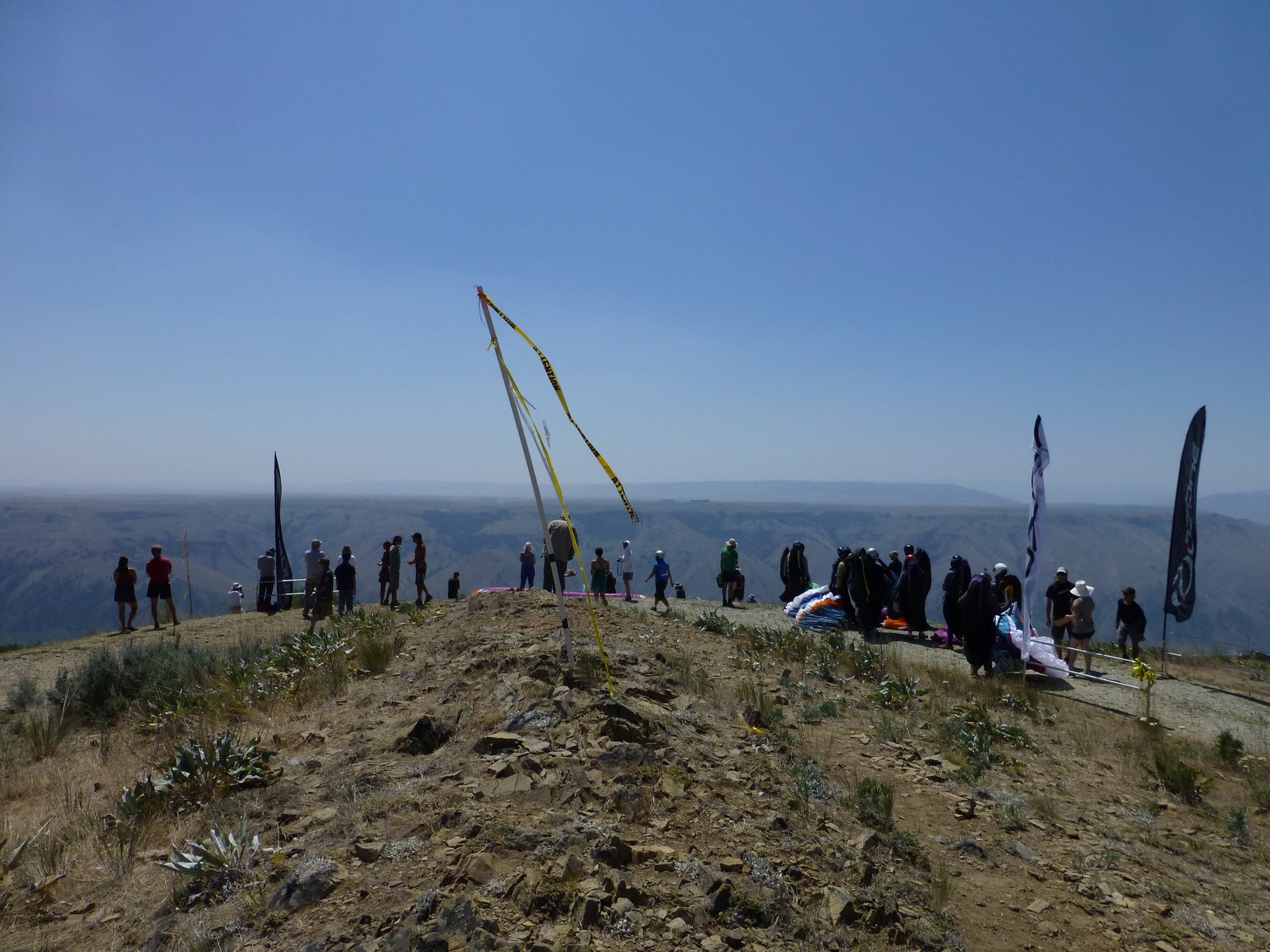
Its quite convenient place, main LZ located on the other side of river, and just 5 minutes drive from the camp. Here is view from launch:
Chelan PG launch
PG pilots waiting in the queue
Main arena for competition is flatland to the east from launch, but getting there especially with low cloud base was very difficult, in fact I bombed out first 3 days (4 with traning day). When you arrive low on other side of the river there are 2 options: try to ridge soar and catch thermal or push toward power lines low with hope to get something on the way. Another problem was that thermals tend to lean a lot from ridge, if you don't drift enough you lose a thermal, if you drift too much you may not come back to ridge line if you lost thermal. On the third day (second task) I was so upset to land again in canyon that I hiked back and relaunched, but was drifting back to the same canyon, I pushed out toward the river, but could not clear another ridge, so I landed, hiked again, relaunched and plan just to glider to main LZ. Instead I got a nice fat thermal and went straight to clould base, tag Simms waypoint and make 2/3 of way back. I probably can make it all the way, but was concerned that reterive will be gone if I don't make it, time was past 7:00 pm. Here is how river crossing looks like from the start:
Flying over Chelan
Last 3 days I was super careful about river crossing, basically you have to cross with main gaggle and need to start about 5 minutes after them and higher in order to get into the best thermal. This strategy worked great, so 3 last tasks was fun racing. Here is view to the launch.
Chelan launch from the air
Landed on the flats
Overall I came in 39th out of 49 pilots, not what I was expecting, but very good learning for me for sure. Swimming in Chelan lake and jumping from the bridge each day also contribute a lot to positive impression from the place.

Saturday, June 23, 2012

Rim to river and back day hike in Grand Canyon

Grand Canyon from South Rim
There're multiple signs in the park that don't recommend to do this hike for a good reason. Its 18 miles (28 km) round trip with evlevation gain of 4600 ft (1400 m), which is not too bad, but day temperature of 115 in the bottom does not uncommon during the summer. To make it safely you have to start well before sunrise. We started at 3:00 am.
Bright Angel trail
Arrived to Colorado river by 6:00 am. Swim was wonderful in the cold water.
Colorado River
 Here is one the warning signs after Indian Garden.
Warning about Rim to the River and back day hiking
Way back was slightly slower (4 hours) because of the heat. Even though it's doable the best time for this hike is certainly not during the summber.

Friday, June 22, 2012

The Narrows in Zion National Park

Quite unusual hike, since you mosly walking in the North Fork Virgin river, mostly ankle deep, but sometimes chest deep or there are even sections where you have to swim. Summer heat compensated by cold water and shade, so its pleasant even when air temperature raise above 100°F.
Mystery Waterfalls in Zion National Park
Light and Shadow
Narrows trail in Zion
Day hike when you go upstream and then come back seemed more resonable then 16 miles one way from Chamberlain's Ranch. Orderville canyon was interesting to explore as well even though we did not made it all the way to first waterfall.
Orderville canyon
Drifting downstream

Monday, June 18, 2012

Glenn Pass from Onion Valley hike

We left LA Friday at 2:00 pm with hope to get our permit the same day. Eastern Sierra Interagency Visitor Center closes at 5:00 pm. We was late by 7 minutes and friendly ranger tell us to come back tomorrow. Its good idea to get acclimatization for high altitude hikes, so we went to Horseshore Meadow (10000 ft /3048 m) for this purpose. Saturday morning we finally got our permit, rent a mandatory bear canister ($2.5 per day) and headed to trail head (9212 ft / 2807 m). Easy hike to Kearsarge Pass (11,760 ft / 3584 m) took about 3 hours. Then I hiked to Mt. Gould (13005 ft / 3964 m).
Kearsarge and Bullfrog lakes from Mt. Gould
Looking south from Mt. Gould to Kearsarge lakes (on the left) and Bullfrog lake (on the right). It took me 2:20 to hike from Kearsarge Pass to Mt. Gould and back. Then we descend to the valley and camped near Kearsarge lakes.
Kearsarge lake
Fish
 Sunday we left most of our staff at camp and attempt day hike to Glenn Pass (11978 ft / 3650 m).
Little lake on the way to the Glenn pass
Gelnn Pass
Rae lakes from Glenn Pass

Monday, May 28, 2012

Sphinx Lakes in Kings Canyon NP hike

I normally hike on trails, but this year start to include some XC sections, which is totally different experience. Trail starts from Road Ends in Kings Canyon, go to Bubbs Creek where we went last year, then continue toward Avalanche Pass, but you have to leave trail before pass and go XC. Detailed description available here
This year snow melted early, but just few days before Memorial Day weekend storm pass over Sierra and left few inches of fresh snow.
 Crossing creek with iced rocks and trees:
 That's where I made it. Lakes starts on the left side of this picture:
I did not have enough time (yes, 11 hours was not enough). I think its better to camp at Bubbs creak and start from there.

Monday, May 7, 2012

SoCal XC League, Laguna, May 2012

Saturday's task was Laguna to Anza, 64 km, elapsed time. This was my first flight from Laguna. Normal route after you get high over launch, which is quite small by the way:
to go to Granit mountain and then to vulcano, but east/west convergency was right in the middle of the valley after Granit, I was flying for 5 km or even more without losing any altitude. There was few pilots climing quite well over San Felipe Hills, so I decide to join them, but lost a lot of altitude on the way there and second gaggle pass me at this point. Most of them headed toward Warner Springs and eventually landed short of it. I took my time to get high and headed toward Ranchita and then continue over high ground (green track). That's where convergency was at this point.
The only problem with this route was mostly unlandable terrain, forest and no roads. Only Aaron had balls to keep following convergence and made goal (red track). Eric and Steve (blue track) landed at camp. I was following unpaved road to this camp for some time, but then decide to bail out toward valley and landed 5 miles past Warner Springs. Just for reference there is no road between Borrego Springs and Anza, hike out from that canyon would be epic.
Task 3 results: http://socalxcleague.pgcomps.net/comps/?op=list_flights&taskID=1786

Forecast for Sunday was better, but we end up with strong east wind and have to move to Horse canyon (my first flight there as well). Conditions at Horse was strong and launches intimidating:
 Jimmy and Enzo:
Some pilots, me included decided that its not worth it and watch the race from the ground:
By 4:00 pm conditions calm down, so we launched as well, but could not get high enough to fly task.
Task 4 results: http://socalxcleague.pgcomps.net/comps/?op=list_flights&taskID=1787