Monday, November 8, 2010

Alta Peak hike

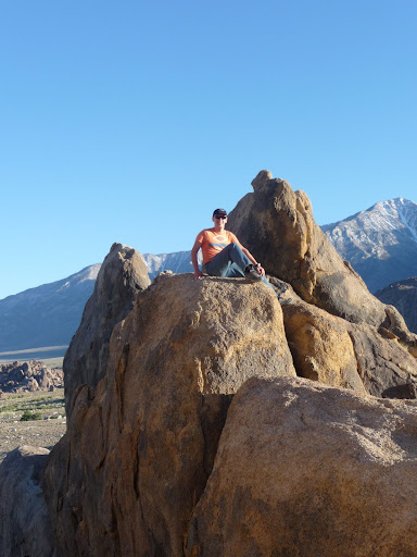
Forecast was for 20% chance of rain on Saturday, but I was desperate to go hiking in Sierra before winter comes in. I saw small bear in Potwisha campground on Friday night, he came to check out what I'm cooking on fire, which is smells so good. Wake up at 6:30 and on trail by 8:00. It starts from Wolverton parking lot (GPS 36.5966, -118.7341), 1.8 miles via Lakes Trail, then 1.0 mile via Panther Gap trail. Until this point you walking in forest and there in not much to see, but after you have a gorgeous view on canyon to your right and high peaks in front. You continue another 4.2 miles to Alts Peak (36.5906, -118.6611, elevation: 11,204 ft/3415 m). It took me 4 hours to get there and 3.5 to come back. Snow/rain finally catch me on the way back.

Tuesday, September 28, 2010

NorCal XC League, Paiute, September 2010


The finale for the Northern California Cross Country League (held on conjunction with the Southern California Cross Country league and the Oregon Cross Country League) was held in the Owens Valley this weekend. It was very successful trip. We flew all 3 days: Sat., Sun & Mon. Weather was similar all 3 days, cross wind from south on launch with light east component on the top of lift. Base was around 13K-15K.

Saturday's task was Paiute -> Boundary Peak -> Bishop (52 miles). I was 2 km short of goal because of strong head wind near Flyns LZ, but few pilots made it.
My GPS track, Results

Sunday's task was similar, but with shorter up wind leg with goal at Benton. There was 40+ pilots flying, including one HG pilot from San Francisco and 30+ made goal this day, including me.
My GPS track, Results

Short task at Monday was straight down wind to Benton. It took us little bit more then 1 hour to make it and again most of the pilots in goal. Many pilots had best flights (longest, highest, etc).
My GPS track, Results

Flight from Paiute, Owens valley, 50 miles from Alex Gagarin on Vimeo.


Overall results for 2010 North California XC league is here. I made it into 6th position this year, which is -2 from last year. Thanks to Jug for organizing such a great competition.

Friday, August 6, 2010

Hiking to Bubbs Creek in Kings Canyon


Last time we spent only 1 or 2 hours in Kings Canyon and I want to explore it more this time. Hiking with a family assume that trail must be easy and choice was between Paradise valley and Bubbs Creek. First 1.8 miles is the same route, but then it splits with Paradise valley going north and Bubbs Creek continue east. Most of the trial going through the forest with multiple river crossing:

Trail is almost flat except section with switchbacks when it climb out from Kings Canyon to Bubbs Creek. In forest we found wild raspberry:
and gooseberry:
saw two deers:
Overall very nice and easy trail we like it a lot.

Sunday, July 4, 2010

Hiking to Gilbert lake in Onion valley

Onion valley located near Independence, CA and looks quite interesting from the air. I flew several times over it and now decide to hike there with family. We camp in Alabama hills:

and drove to trailhead in the morning. Trail going through Pine trees, so its not too hot even in the middle of the day. We made it only to second (Gilbert) lake:

but with enough time Kearsarge Pass is doable even with a small kid, OK, maybe next year.

Saturday, June 12, 2010

Pine to Antelope Valley flight, 52 miles

I flew with Jonathan and Tony Deleo. We arrived to launch around 10:30 and wait for thermal cycles block light north wind around noon. We all climbed to 11K or so and headed NE toward Lockwood valley, hang gliders choose fastest and most reliable route A (see following picture):

The problem with route A is that if you don't find lift its a long glide out through strong west wind, which is feeding convergence. I have tried this route before and it was not successful, so this time I decide to try more conservative route B. There are many LZs available in this direction, thermals usually are not well defined, but in my case there was two forming clouds. When I made it to Lockwood valley it was mostly covered by clouds, regardless I had a good glide toward Frazier:

After Frazier its quite tricky to make transition into Antelope valley. There are 3 different air masses mixing here. One is a stable air from Central valley, then breeze coming from Santa Barbara (via Pine) and last one hot and dry air from Mojave desert. General advice is to climb as high as possible over Frazier and then glide toward Quail lake. Well, I try to gain some altitude there, but left it at 9K without much hope. Got really low near Gorman and was ready to land when find a good thermal, which gave me another chance. Topped out at 9600 near I-5 and 138 intersection and headed toward Quail lake:

North wind changed to SW. After crossing the lake I got down to 5500, but once again manage to find very strong +7 m/s (1400 fpm) thermal and continue. At this point Tony and Jonathan landed and Jonathan reported surface winds 15 mph gusting to 30 from the SSW near the mountain, so I decide to land before it pick up even stronger. Another reason for landing was my unpreparedness for this flight in particular I forget to upload class D Lancaster, Palmdale and restricted R-2515 airspace to my GPS and had no idea where they are. But first I want to flew north, out from the mountain, so wind would be at least not turbulent, which I did. I landed backwards and here is illustration to wind profile near the ground:


Flight from Pine Mt., 52 miles from Alex Gagarin on Vimeo.


My GPS track: http://www.paraglidingforum.com/leonardo/flight/339840

Discussion on Santa Barbara forum: http://scpa.info/bb/forum/viewtopic.php?f=1&t=1905

Monday, June 7, 2010

Torrey Pines flight

Actually flight was done in May, but it took me a while to edit and post. I try foot mount for camera, which is work pretty well and Torrey is a perfect place to experiment with camera mounts, speed bar, etc.

Paragliding at Torrey Pines from Alex Gagarin on Vimeo.

Wednesday, June 2, 2010

Walt's to Big Pine flight, 43 miles

There was 6 PG this year, looking to fly from Walt's on Memorial Day weekend. Number shrink to 3 on Friday (Me, Jonas and Arnie), but it was still 50% more then last year. There was north wind at Saturday and west at Monday, so we decide to fly only Sunday. Initial plan was to camp at Horseshoes Meadows at 10000 ft altitude to get some acclimatization, but -3C° at night convinced us to camp in valley. Lone Pine camp was good place to stay and we also did some rock climbing just before sunset:

Sunday 8:00 am we met Tony, Jeff (HGs) and our driver Mike and headed to launch. There was almost no space left at 9:30, but weather did not turn on until 12. After getting up in saddle I flew back to mountain behind launch and then continue north. Most of the flight we spend with Jonas and Arnie who took off 15 minutes after us manage to overtake us. There was a huge high cloud passing from north to south, which shut down thermals for probably 15 minutes. HG who launched just before it (including Tony and Jeff) had nothing, but sink and has to land. We climbed as high as possible and circled in zero sink waiting for cloud to pass by and then continue down range. Our "favorite" Onion's valley did not disappoint us again. Strong WSW wind turn on washing machine and I have to leave mountains earlier then I want to, but Arnie manage to flew further over high terrain, which allow him easy crossing to Whites and flew to Janie's (100 miles). Jonas try to stay in the mountains too, but not deep enough (40 miles):


There was also many sailplanes along the route, which is fun to watch from the distance, but could make you nervous when thermal close enough. Here is a video:

Flight from Walt's to Big Pine, 43 miles from Alex Gagarin on Vimeo.


GPS tracks: Alex, Jonas and Arnie

Discussion on HG forum: link

Arnie's photos: link

Monday, May 17, 2010

Garlock to Olancha flight, 55 miles

Forecast was for 5-8 mph south wind almost whole day, cloud base 12K near Garlock and 14K+ in Sierra. Logistics was little bit complicated because Tony Deleo initially plan to fly from Black Hawk and my only choice was to join Joe Greblo's group riding from Sylmar. I was not even sure they have room for me and will allow me to go with them, but I took that risk and came at Sylmar LZ at 7:00 am. After short conversation Joe give me good to go and at the same time Tony call and tell that they coming to Garlock too. Arriving at launch about 11:00, clouds was everywhere already, light thermal cycles. I spend about 15 minutes by clearing west launch from bushes and rocks. Tony took off first, then me and then John (Southside). I had tangle in lines, which I could not clear. It was near center of trailing edge and did not affect wing behavior much, so I decide to go with it rather then top land and struggle again with bushes and rocks risking to cut my lines. I find a good thermal in front of launch and 3 of us topped out at 6200 then Tony went on glide to Black Mt., John find another thermal right away and I sink out to launch altitude. Next one gave me about 7500, which seems enough for transition to Black. But going through strong sink I arrived slightly below top of Black. There is long section of Bad Lands after Black Mt. and I could not find good solid thermal to get up, jumping from one "so-so" thermal to another one and basically maintaining same altitude. There is a retrievable road behind Bad Lands and when I made there I really could relax, but 300 AGL did not leave me many options. I was ready to land when heard "beep-beep-beep" indicating that game is not over yet. Now back to cloud base near intersection of 178 and 14 I don't even need to go to Boomer ridge and glided north along 14. Most of the cloud was back in the mountains, but I prefer stay in front, speed system was surely affected by tangle and I did not want to be trapped. Getting close to Olancha, John reported that he is landed safely near road next to power lines. I also was low and landed near paved road. By the time I finished packing my staff Eddie picked up John and was looking for me. Then we chase Tony to Luning, Nevada, had a quick dinner at Bishop and drove back. I got back home at 2:00 am.

Flight from Garlock to Olancha, 55 miles from Alex Gagarin on Vimeo.

Links:
My GPS track
Tony's 214 miles story
Many pilots from Sylmar crew flew 40 miles to Trona

Sunday, April 18, 2010

Saturday, April 17, 2010

Marshall flight, 8 miles FAI triangle

Base was too low for long flights, so I just flew small triangle from Marshall to Crestline ridge then Pine Mt. and back to Marshall. Here is a video from my GoPro

Marshall, Crestline, Pine Mt. from Alex Gagarin on Vimeo.

Camera angle was too low, but I'm still learning this thing. Its already adjusted for next flight.

GPS track:
http://www.paraglidingforum.com/leonardo/flight/317293

Tuesday, March 30, 2010

Marshall to Calimesa flight, 22 miles

Forecast was for 8K cloud base, wind switching from North to SW in general and 10-15 mph North diminishing to zero in Cajon pass and 15-20 East in Banning pass. The whole XC crew decide to go: Bruce, Rebardan, Owen, NMERider, Southside, and Wally drive a chase. I was lucky to squeeze in Bruce's Suburban. Out and return seems most reasonable challenge for the day and everybody flew East first and then try to come back, except NMERider who opted to tag Cucamonga first, which he did. Here is combined track logs (made by NMERider):

As for me I climbed in house thermal just after launch and flew back to Crestline ridge, but did not had much success to get up there and go back to front range. I spend a lot of time near Arrowhead peak trying to get some altitude, but after 30 minutes give up and commit transition arriving quite low. Then condition improves and I start climbing higher and higher. Thermal with Bruce near Harrison peak, but lost him after DAM. DAM was my intended turn point, but with moderate SW wind I could not even come back to Harrison, so I decide to fly open distance instead. Trying to avoid strong winds in Banning pass after highway 38 I turn SSW and flew over flatlands landing next to I-10. Here is some video from my GoPro HD:

Marshall Paragliding from Alex Gagarin on Vimeo.


GPS Track: http://www.paraglidingforum.com/leonardo/flight/309344
Thanks to NMERider for retrieve.

Monday, March 29, 2010

Dunlap Video

Video highlights from my flight in Dunlap from last week

Paragliding in Dunlap from Alex Gagarin on Vimeo.

Tuesday, March 23, 2010

NorCal XC League, Dunlap, March 2010


Forecast was so so for both days, wind light and variable, high clouds and weak thermals and it materialized as predicted. But it was nice to see everybody after long winter and fly over green Dunlap valley. Flowers just started to bloom.

Saturday's task: DNLNCH 49917 LASTCH GRNY 49917 DNLNCH RNGSTN and goal at DAN's LZ looks easy on the ground, but in the air it was a different story. Just after start was opened high clouds almost shut down thermics and most of pilots push forward quite low. I had a slow start and was probably last one on course. I recently bought a Helmet HD Camera which allow me to capture several interesting moments:

Stephan's collapse from Alex Gagarin on Vimeo.

I know that proper route after LASTCH was to come back to main ridge and go to launch area first and then cross to GRNY, but I just did not feel I should push for it and DAN's LZ was so inviting that I can't resist:

Only Josh made goal, Timo second and Susan 3d. I'm #14. Saturday's Results
Sanday task was exacltly the same except radius over RNGSTN was increased to 1 km, but still nobody made it. Several pilots had problems on launch I captured Kansas:

Kansas launch from Alex Gagarin on Vimeo.

After Saturday's warmup I feel much more confident and we (second gaggle) even tag GRNY, but could not made it back on main ridge and again I landed on DAN's LZ. Sunday's Results

Monday, February 15, 2010

Weather forecast for XC route planning

Here is a list of resources I use to determine weather potential:

NWS - US National Weather Services
I use it to see what kind of weather expected in 3-5 days in general. Is there are any rain or storm expected, temperature trend. There is also Radar and Satellite Images available, which tells you how storms moving, where and what kind of clouds in the area.

RASP San Diego
RASP Santa Barbara
RASP Sierra Nevada
RASP - Regional Atmospheric Soaring Prediction. This is main XC planning tool, which is available online and shows you distribution of cloud base, wind speed and direction, convergence lines, expected cloud development and overdevelopment potential across region. The most important parameters are listed below:

Hcrit - is basically cloud base, MSL. For good flight you need at least 3000 ft. over terrain. Of course, you can fly with lower cloud base, but I don't count on a good result in this case and don't take a vacation day in the middle of the week.

BL Avg. Wind - if cloud base looks good next thing to check is a wind direction and strength. For PG wind strength in forecast should not exceed 10 knots, because in reality you can expect double of predicted wind speed due to addition of thermals, valley wind, compression and other factors. Depending on wind direction you need to determine launch point and anticipated route. After this step you need to come back to previous parameter and make sure that Hcrit is good along entire route. Keep in mind timing factor, condition changes along the day, so you need to know when and how wind direction will change. Of course, it's very approximate in forecast, but you must know at least general trend.

BL Max. Up/Down (Convergence) - If you anticipated route doesn't match to convergence lines then you need to reconsider your route one more time.

CU Cloudbase where CuPotential>0 - Useful to know where clouds will be forming and how high they're expected.

CU Cloudbase where ODpotential>0 - Overdevelopment is common on a good days, so be aware.

windguru.cz
This is good tool to visualize GFS and NAM forecasts. You need to register (free) to create your own custom spots and forecast set. I use it to see wind speed, direction, precipitation and cloud cover (high, mid, low) on launch spots. It also calculates correct temperature on launch, taking into account it altitude.

NOAA Ready - National Oceanic and Atmospheric Administration
I use it to see sounding and stability, based on NAM 12 km, NAM 40 km and GFS forecasts. Stability is similar to combination of RASP Thermal Updraft Velocity and Hcrit, but calculated for one point and shown as graph in time. Sounding helps to determine thermal and wind strength, wind direction, depending on altitude. Even points of interest are similar to RASP, sounding provides raw data for all important parameters, when RASP shows you only average values. NOAA Ready is very useful for verification of flight concept made based on RASP.

NWS weather history
Before going to fly it's useful to check current wind and past day weather history. In the link above you can change KBUR code to other airport for example, KSBA - Santa Barbara, KVNY - Van Nuys, KSBD - San Bernardino.

Tuesday, February 2, 2010

Snowboarding at Mammoth Mountain


I don't snowboard as much as 10 years ago when I started, but still try to go few times per year. There are several places around LA with biggest, probably, Big Bear, but all of them doesn't even close to Mammoth Mountain, located 300 miles north from LA (~6 hours drive) in Owens valley, Eastern Sierra Nevada. Even on crowded weekends there are a lot of free space there and its easy to find lift with fewer people. However the best option is going there next day after storm on the week day. Hotel prices also much higher on weekends and room may not be available unless you book a week or 2 in advance.

We got lucky with conditions and had a lot of riding both Friday and Saturday.

Monday, January 25, 2010

Kagel flight, 6 miles


North winds and winter storms was in place for quite a while. However this weekend was perfect exception with post frontal conditions. Peaks of the local mountains covered with snow from recent storms, smooth winter thermals, warm sun and birds showing you the best lift, what could be better? Spring, of course. But spring is still two months away and its essential to get ready before it comes.