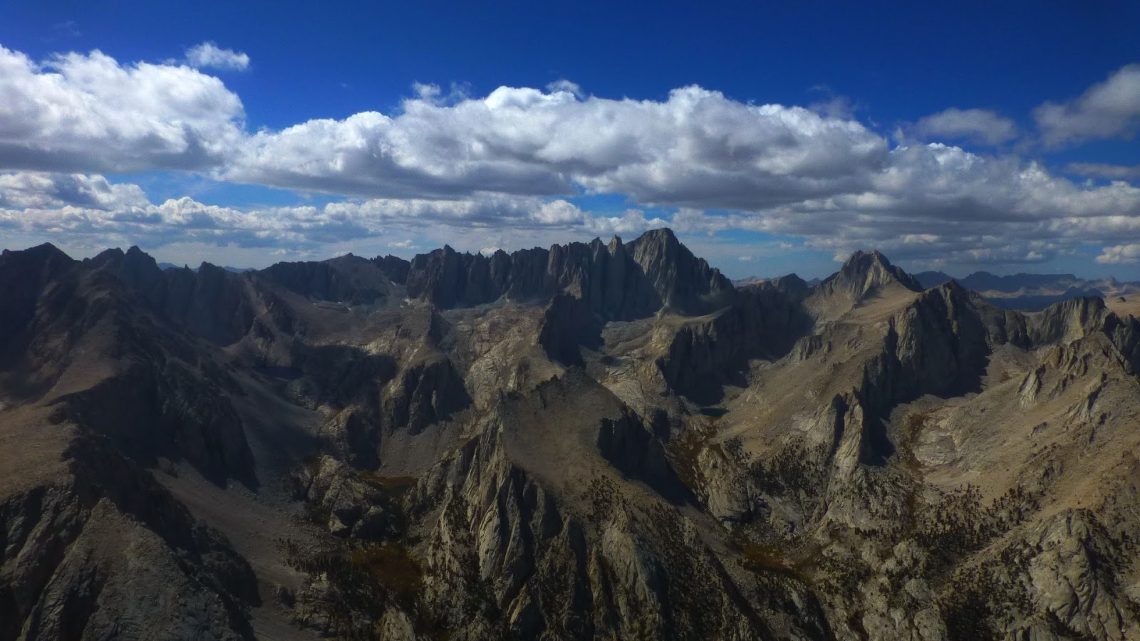
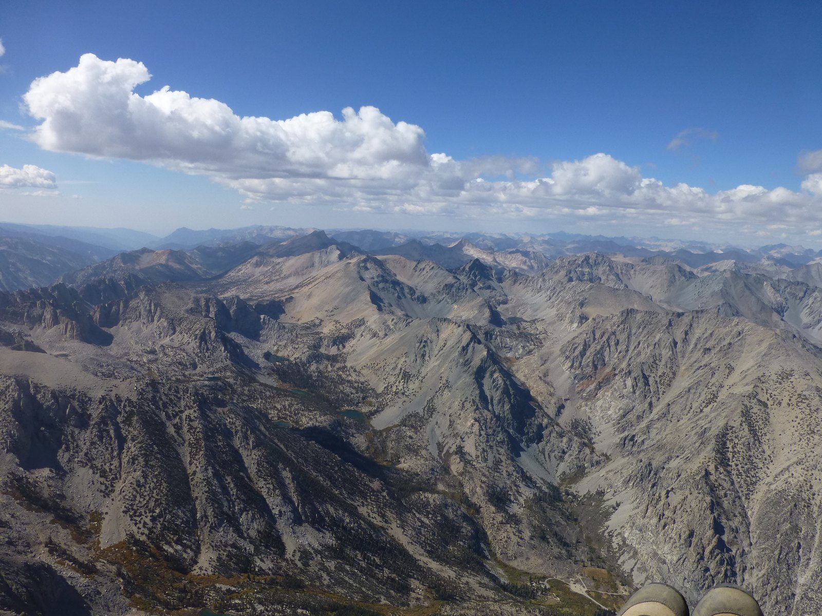
I have been on Mt. Gould (13,012 ft) once before and it's an easy scramble from Kearsarge pass, probably one of the easiest 13ers, so excellent choice for mountain introduction. Fedor and Eugene joined me for adventure. I also decided to make it a loop this time, coming back via Golden Trout Lake. The most interesting part was to get down to the lake, we choose north side and it did work out fine.
Mt. Gould loop trail map
Kearsarge Pass
Golden Trout Lake
Mt. Gould register
Summit block of Mt. Gould
Rae Lakes
Descent to Golden Trout Lake
It took us 10 hours car to car, cross country part was super slow, requiring a lot of bolder hopping and dealing with the scree.
After our spring flights I was very comfortable to fly deep over the Palisades and fall didn't disappointed. In the beginning of the flight I was finally able to fly right over Mt. Whitney with Gavin performing awesome wind overs in front of the peak.
Mt. Whitney
Tulainyo Lake
After Big Pine we flew deep into Palisades, but after Mt. Tom we split. Gavin went straight over Wheeler crest toward Mt. Morgan and I stayed over Wheeler crest eventually landing just before Mammoth lakes. Gavin flew straight line and was able to make it almost to Lee Vining.
No, it's not a single flight, but still 529 km in 3 days quite impressive result for our annual Memorial Day weekend in Owens.
Hang glider launching from Walt's point
Saturday May 27, 2017. Still a lot of north wind in the morning, pretty late start at 12:51 and difficult turbulent conditions. I flew to Bishop, mediocre, warm up 101 km flight in 4:35 hours.
Track: http://www.paraglidingforum.com/leonardo/flight/1637056
Flying over Sierra Nevada mountains
Sunday May 28, 2018. Conditions improved, prevailing SE wind whole day, no switch to SW even for Mammoth Lakes, so we decided to stay on Sierra side and it worked out. Started at 10:34, uneventful flight to Big Pine (by 1:30) and then transition toward Aspendell. This is first time I flew this line, so looking for landings, triggers and terrain in general. I followed not very distinct ridge, which worked out just fine.
Sailplane over Coyote Flat
By 2:30 I'm at Mt. Tom, no problems with lift, topping at 17K or so. At this point I'm making mistake, which cost me time and almost put me to the ground. Instead of going directly over Wheeler Crest (usually very unpleasant place), I'm going around. After one more climb at Crowley Lake I'm almost landed just before Mammoth Lakes.
Crowley Lake
Low save put me back in the game and I'm also in the convergence now, following highway 395. After almost 30 miles without turning (final glide) I landed at 5:07 at Lee Vining airport. I had some issues with blur vision during last hour of flight, one of the symptoms of hypoxia. Open distance 187 km in 6:33 hours.
Track: http://www.paraglidingforum.com/leonardo/flight/1637060
Mono Lake
Lee Vining airport
Monday May 29, 2018. Potential for thunderstorms later in the day, wind direction changed to more south and it's also much stronger all the way to Nevada, potential for a record flight. I'm starting right after Dave Turner at 9:46 and with good tail wind speed is amazing. By 11:30 I'm starting to cross near Big Pine, Dave will stay on Sierra side entire day. Getting few small climbs in the valley, but my main problem is wind direction is still SE, so I'm in the lee of White Mountains. Typically cloud street (which marks convergence) is right over the crest, but today it's pushed all the way to foothills on the west side. I connect, but trying to stay in foothills or even valley, slowly getting into convergence. By 2:00 I'm at Boundary Peak, realizing this could be a record day. This is a key point where I made mistake by going NE toward Mina. Wind is still from SE and strong, which means I'm flying 90 degree to wind, wasting time and energy, clouds directly to the north also looks much better. I'm having my blur vision issue again and landing at Mina at 4:20, open distance 213 km. Dave flew to Tahoe, but got suck into thunderstorm and it's unclear what happened to his GPS track (device malfunction or he broke 18K limit?). For me ideal line after Boundary Peak was NNW toward Hawthorne staying under cloud street, directly downwind. My decision to jump to Whites was risky, since I could land early, but payed off later because I avoided thunderstorms over Sierra (from Mammoth to Tahoe).
Track: http://www.paraglidingforum.com/leonardo/flight/1637070
Igor and Mike (HG pilots) was organizing a trip to Owens, so I and my friend Dmitry from San Diego decided to join them. We all met Friday night at Boulder Creek RV camp, just few miles south from Lone Pine. HG want to fly Walt's, but Dmitry want to fly Nine Mile, so we took his car and drive to Nine Mile Saturday morning. When we hiked to launch at 9:30 it was already windy from SE (15 mph) and I had doubts about launching. By 10:00 am wind was pretty much the same (good), so I launched and Dmitry follow me shortly. We climbed easily to 10K and went north. Weather forecast was so-so with north wind in the morning switching to south in the afternoon. HG pilots at Walt's had to wait until 11 or 12 before they can launch, but we was 40 miles south and had advantage, it was already south here. However, along the flight we encountered north wind couple times, which made our progress quite slow. By the time we made to Whitney there was already signs of over development in the mountains and I try to stay out front. But real OD happened only at 4:00 pm and I have to escape from Sierra. I found a thermal near Big Pine and could get higher there, but OD looked scary and I decided to cross without necessary altitude and finally landed at 4:40 pm. Total distance 94 miles duration 6:40 hours. While I was hiking out to highway 168 one gentlemen offer a ride to Big Pine. Turned out he was a long time hang glider pilot, but retired 10 years ago and don't fly anymore. Dmitry landed closer to Bishop along 395 and also managed to hitch a ride to Big Pine where we met. Igor flew locally and landed at Diaz Lake. He took my car and pick us up at Big Pine, thanks a lot Igor. We got Dmitry's car on the way back, home by midnight or so.
Here is a video covering first part of flight from Nine Mile to Walt's:
Combined North and South California XC league meet was scheduled for weekend of September 29 and 30, but many pilots decided to come early that week to fly from Walt's point and new hike-up launch Nine Mile, which is 40 miles south from Walt's.
Nine Mile launch
Dean was the one who picked the spot up from Google Earth and flew with Aaron first time breaking his own California's open distance PG record. Well, next week or so he flew again with Jimmy and they broke the record again. September is not good time to set a records because days are short and conditions generally mild, but 2 out of 2 successful attempts prove the site has a good potential and many pilots including Timo, Jug, Steve, Jim, Josh and others was excited to check it out.
PG Pilots on Nine Mile launch
Its 25-30 minutes hike from the road (500 AGL) and you need to be ready by 9:30. Launchable window is 30-45 minutes when wind from "too light" becoming "too strong". There is no LZ other then hillside landing (Cactuses, Joshua trees, rocks, etc) or landing on the road. There is ugly looking canyon below the road and glide to main valley from launch is 8:1. Josh was first to launch around 10:00 am, then Jimmy and I was off at 10:13 followed by Dean, Jug and others. We spend maybe 15-20 minutes to get our first climb from 5500 ft launch altitude to 11K and game was on. Lead gaggle Josh, Jimmy and Dean disappeared beyond horizon immediately. The rest of the pilots leapfrogged for first 100 miles along the Sierra with many pilots landing after Big Pine. Here is couple good shots from that part of the flight.
Olancha Peak
Whitney
Kearsarge Pass
Just before Big Pine I was flying with Steve and blue Omega 8 and we was pushing hard leaving thermals lower and lower and eventually I found myself peaking up LZ in the foothills with prospect to hike about 5 miles to the paved road. The best way to handle such stressful situation is to accept the fact you already landed it helps to calm down and concentrate a lot. Anyway, I run into a good thermal, drift with it and took my time to get as high as possible before "The Crossing" toward Black Mt. in the Whites mountain range.
Crossing Owens valley
Start crossing from 11.5K just 3 miles west from Big Pine and arrive with 1.5K AGL. It feels like wind was still little bit from the east direction, so I was not in hurry to climb and ridge soar few mile to the north instead and only then took a climb. By that time there was few rescue operations under the way. One pilot had a hard landing after low collapse on Sierra side, he was ok, but have to hike out for couple hours. Another pilot throw reserve near White Mountain and his friend top landed to help. There was also huge overdevelopment on the Sierra side and entire valley got into the shade, so flying become quite challenging.
White Mountains
My goal was to break 200 km, which I did and landed at 6:13 pm few miles south from Benton, with total 8 hours in the air, 212 km open distance, my personal best so far. Thanks to Joe for picking me up.
Record amount of snow this season delayed Horseshoe Meadows road opening, which leads to Walt's point PG/HG launch in Owens valley. I was calling ranger station since May to check when it can happen. Finally road was opened at June 8th. There was a big group of pilots from Crestline/Sylmar planning to fly Father's day weekend, but the best weather was for Wednesday 15th, so instead of waiting we decide to go for it. Wake up at 3:00 am, pick up Eddie our driver from Ventura at 4:30, back to home and meet with Jonathan at 5:45, made Lone Pine by 8:45. Our typical meet place in Lone Pine, High Sierra Cafe was closed this year, so we meet with Marcus (HG) and PG pilots from Tahoe on Whitney Portal road. At launch by 9:45. Day did not start until 11:00, so I had some time to walk around and get used to altitude. Since I had entire launch for myself I want to try new launch techniques. Tried reverse launch from plateau, but it did not work out, not enough wind. Then forward launch was successful. It’s harder to execute, but safer because you can stop easily as opposed to launch from steep rocky slope, which I usually do. Air was rough and turbulent from beginning, got few small asymmetric collapses, but major one was few miles into the flight. It started from 50%-60% asymmetric and reopened just fine, however I pull opposite brake too hard (hello hypoxia?) and spin a glider. Exit a spin fine after 360, still around 200 meters over terrain. I did not want to be deep after this point and headed out toward the valley where thermals were nicer. The rest of the flight was uneventful. Jonathan catch up after Onion valley and landed before Big Pine, Marcus before Bishop. There was SE/W convergence line running straight north through Bishop, but it stopped after 5-7 miles. There was massive development over Boundary Peak and clouds show NW out there. I opted to land just next to Marcus on nice, green meadow. 10 minutes later Dave, another PG from Canada joined us. Back to Lone Pine at 6:00 pm and back home at 12:30 am. Good, long day!
The finale for the Northern California Cross Country League (held on conjunction with the Southern California Cross Country league and the Oregon Cross Country League) was held in the Owens Valley this weekend. It was very successful trip. We flew all 3 days: Sat., Sun & Mon. Weather was similar all 3 days, cross wind from south on launch with light east component on the top of lift. Base was around 13K-15K.
Saturday's task was Paiute -> Boundary Peak -> Bishop (52 miles). I was 2 km short of goal because of strong head wind near Flyns LZ, but few pilots made it. My GPS track, Results
Sunday's task was similar, but with shorter up wind leg with goal at Benton. There was 40+ pilots flying, including one HG pilot from San Francisco and 30+ made goal this day, including me. My GPS track, Results
Short task at Monday was straight down wind to Benton. It took us little bit more then 1 hour to make it and again most of the pilots in goal. Many pilots had best flights (longest, highest, etc). My GPS track, Results
Overall results for 2010 North California XC league is here. I made it into 6th position this year, which is -2 from last year. Thanks to Jug for organizing such a great competition.
There was 6 PG this year, looking to fly from Walt's on Memorial Day weekend. Number shrink to 3 on Friday (Me, Jonas and Arnie), but it was still 50% more then last year. There was north wind at Saturday and west at Monday, so we decide to fly only Sunday. Initial plan was to camp at Horseshoes Meadows at 10000 ft altitude to get some acclimatization, but -3C° at night convinced us to camp in valley. Lone Pine camp was good place to stay and we also did some rock climbing just before sunset: Sunday 8:00 am we met Tony, Jeff (HGs) and our driver Mike and headed to launch. There was almost no space left at 9:30, but weather did not turn on until 12. After getting up in saddle I flew back to mountain behind launch and then continue north. Most of the flight we spend with Jonas and Arnie who took off 15 minutes after us manage to overtake us. There was a huge high cloud passing from north to south, which shut down thermals for probably 15 minutes. HG who launched just before it (including Tony and Jeff) had nothing, but sink and has to land. We climbed as high as possible and circled in zero sink waiting for cloud to pass by and then continue down range. Our "favorite" Onion's valley did not disappoint us again. Strong WSW wind turn on washing machine and I have to leave mountains earlier then I want to, but Arnie manage to flew further over high terrain, which allow him easy crossing to Whites and flew to Janie's (100 miles). Jonas try to stay in the mountains too, but not deep enough (40 miles):
There was also many sailplanes along the route, which is fun to watch from the distance, but could make you nervous when thermal close enough. Here is a video:
Forecast was for 5-8 mph south wind almost whole day, cloud base 12K near Garlock and 14K+ in Sierra. Logistics was little bit complicated because Tony Deleo initially plan to fly from Black Hawk and my only choice was to join Joe Greblo's group riding from Sylmar. I was not even sure they have room for me and will allow me to go with them, but I took that risk and came at Sylmar LZ at 7:00 am. After short conversation Joe give me good to go and at the same time Tony call and tell that they coming to Garlock too. Arriving at launch about 11:00, clouds was everywhere already, light thermal cycles. I spend about 15 minutes by clearing west launch from bushes and rocks. Tony took off first, then me and then John (Southside). I had tangle in lines, which I could not clear. It was near center of trailing edge and did not affect wing behavior much, so I decide to go with it rather then top land and struggle again with bushes and rocks risking to cut my lines. I find a good thermal in front of launch and 3 of us topped out at 6200 then Tony went on glide to Black Mt., John find another thermal right away and I sink out to launch altitude. Next one gave me about 7500, which seems enough for transition to Black. But going through strong sink I arrived slightly below top of Black. There is long section of Bad Lands after Black Mt. and I could not find good solid thermal to get up, jumping from one "so-so" thermal to another one and basically maintaining same altitude. There is a retrievable road behind Bad Lands and when I made there I really could relax, but 300 AGL did not leave me many options. I was ready to land when heard "beep-beep-beep" indicating that game is not over yet. Now back to cloud base near intersection of 178 and 14 I don't even need to go to Boomer ridge and glided north along 14. Most of the cloud was back in the mountains, but I prefer stay in front, speed system was surely affected by tangle and I did not want to be trapped. Getting close to Olancha, John reported that he is landed safely near road next to power lines. I also was low and landed near paved road. By the time I finished packing my staff Eddie picked up John and was looking for me. Then we chase Tony to Luning, Nevada, had a quick dinner at Bishop and drove back. I got back home at 2:00 am.