|
| Map |
Mt. Muir was last California 14ers for me to complete. It's located in Whitey Zone and requires permit. We even got an overnight permit for Whitey for end of June, but due to fire it was canceled, so I have to do some improvisation. Instead of direct route I decided to start from Meysan Lakes and do loop with few bonus peaks.
 |
| Foothills after recent fire |
 |
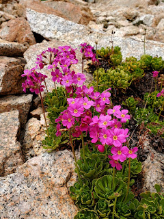
| Meadow near Meson Lake |
 |
| Between rock and ice |
 |
| Mt Mallory |
 |
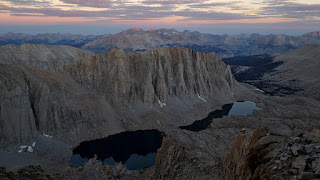
| Bivi spot at 13,000 ft |
 |
| Mt. Irvine |
 |
| Sunset |
 |
| Mt. Langley |
After sleeping at 13'000 ft. my first peak was
Mt. Mallory. Initially I try to traverse on the west side, but stuck at sketchy down climb and have to go all the way back and hike 150 ft down and use one the chutes to went up, which worked out. On the way back I use the path where I stuck in the morning, since going up was much easier.
Mt. Irvine was easy, there was some interesting sections going down toward Arc pass, but nothing memorable.
 |
Chimney
|
My 3rd objective was Mt. McAdie, but I run of water and have to detour to unnamed lake to refill and come back to Arc Pass. It was getting late in the day and I decided to leave McAdie for next time and descended via Arc Pass to Consultation Lake.