Saturday, November 14, 2020

Skyline

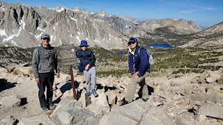
 I have been organizing annual Skyline hike for the last 10 years, which was a great success with different groups of friends connecting together and having a good time. On some years we also hike it in the spring to see blooming flowers. This year first storm was hitting SoCal just 1 week before our hike, so we could see a full contrast from 100F in the valley to snow on the top.

2020 Skyline hikers


Snow at the top


Temperature in the valley


Saturday, August 8, 2020

Palisade Traverse

According to the Internet:

Palisade Traverse is one of the best alpine climbs in the Sierra Nevada and one of the very best ridge traverses on the planet. This route takes in five 14,000 foot peaks and features amazing views and exhilarating climbing.

It includes following peaks:

  • Thunderbolt (14,009 ft)
  • Starlight (14,226 ft)
  • North Palisade (14,248 ft)
  • Polemonium (14,080 ft)
  • Sill (14,153 ft)

Haytham joined me on this adventure and was already familiar with first 2 peaks and route between them, which helped a lot. We decided to go from the west side and camped near Bishop pass on the first night. We started from Bishop pass around 3:00 AM, reached Thunderbolt pass by 5:30 AM, and went up the Southwest Chute #1.

Thunderbolt Southwest Chute #1

We get to Thunderbolt around 8:30 AM and was lucky to find another group there who allowed us to use their rope. Summit block is unprotected 5.9 boulder problem and I was not very excited to leaded it unless I have to.

Starlight from Thunderbolt

Route to Starlight involved some not very obvious detour to the right, which saved us a lot of time. Another group went in the middle of the ridge and have to rappel for awhile. They did not even get to the saddle by the time we were on Starlight already. After the saddle you have to go even more right and around to avoid class 5 climbing.

Looking west

Down climb to Thunderbolt-Starlight saddle

We got to Starlight around 11:00 AM and Haytham lead the 5.4 summit block. I was doing ok, but start feeling altitude somewhere around this point.

View from Starlight

Looking west from the ridge

By 2:00 PM we reached North Palisade, and my altitude sickness progress to the point I can't move very fast, so we decided to call it a day and descent from U-notch (to the west of course). From the North Pal. we missed the correct path, which supposed to go right (west) and end up on pretty bad rappel path with sketchy anchors, falling rocks, etc., so I would not recommend going that way.

Looking SW from North Pal.

Looking west from U-notch

Sunset at 8:00 PM

We was hoping to hike out the same day, but that was unrealistic. We reached our campsite around 9:30 PM, packed out and hiked lower to the Bishop lake and spend another night.

Here is what can be done better next time:

  • Better acclimatization. For 1 peak it does not really matter, but for traverse where you spend a lot of time above 14K it's crucial.
  • Start should be as close to the route as possible. We wasted probably 4 hours hiking in and out. Camping at Thunderbolt pass (or on the east side) would be much better.
  • 3 days minimum. Trying to squeeze it into 2 days was a mistake.


Friday, July 17, 2020

Mt. Abbot (attempt)

 Trail to Mt. Abbot (13,711 ft) starts from Little Lakes Valley Trailhead (Rock Creek) conveniently located at 10,200 ft. Only Fedor joined me this time. We slept at trailhead and started early in the morning hoping to tag Mt. Abbot via North East Couloir and camp either near Mills lake or Treasure Lakes.

Mt. Abbot map
There is a good trail going up to Mono Pass, but after Ruby Lake, it's all cross country and the higher you go, the more obstacles you encounter, all of them not harder than class 2 though.
Ruby Lake

Mills Lake (top one)

North East Couloir of Mt. Abbot (left)

We was able to get to the beginning of couloir (~13,000 ft) when 3 contributing factors helped me to abort the mission: Fedor start feeling altitude with light headache, storm was forming to the north of us and it was almost 2:00 PM, kind of late. We took few pictures and continue to Treasure Lakes.


Treasure Peak
Descent to the Treasure Lake was difficult (at least class 2) and slow since Fedor's headache become worse, so I was glad we did not go all the way to the peak. He needs more time for proper acclimatization and camping at lower altitude helps a lot.

Fishing at Treasure Lake

Treasure Lakes are at 11,200 ft. After eating soup and drinking hot tea Fedor feel much better and went fishing, but did not catch anything, we need to practice more.

Our campsite
Next morning it was easy stroll to the trail head, I think we stopped at pretty much every lake to test our fishing luck, but still did not catch anything.

Treasure Lake


Little Lake Valley


Friday, July 3, 2020

Mt. Tyndall

 Mt. Tyndall (14,026 ft) located near Mt. Williamson and most of the parties climb them together coming from Shepherd Pass (12,020 ft). We did Williamson in 2019 via North Fork of Bairs Creek (from the east) and Tyndall was not an option at that time, so I have to come back to tackle it. After Mt. Gould, Fedor and Eugene was super motivated to climb 14er.

Crossing Shepherd Creek

Looking back
On the first day we hiked to the second small lake just past the Shepherd Pass, around 12 miles with 7000 ft elevation gain.

Selfie near Shepherd Pass 

It was quite cold at the night and I was glad I bring tent and lend it to Fedor and Eugene, since they did not have sleeping bags adequate for that temperature.

Mt. Tyndall, North Rib right in the middle

Moon rising over the lake

 We set alarms for 6:00 AM, but Fedor and Eugene both choose not to climb Tyndall in the morning due to altitude sickens, so I went by myself. It was only 1 mile to the top from our campsite with 1750 ft of elevation gain. It took me 2 hours to get to the top and another hour to get back. I was done by 9:30 AM.

In the middle of North Rib

Here is few pictures from the summit in different directions.

Mt. Whitney in the distance

Mt. Williamson

Shepherd Pass and our camp (right lake)

Looking back I think we should spend night at Anvil Camp (10,000 ft). That would reduce our efforts to carry camping gear on the 1st day and what's more important minimize altitude sickness, so everyone would have a better chance to climb Tyndall on the following day.

Saturday, June 20, 2020

Mt. Gould

I have been on Mt. Gould (13,012 ft) once before and it's an easy scramble from Kearsarge pass, probably one of the easiest 13ers, so excellent choice for mountain introduction. Fedor and Eugene joined me for adventure. I also decided to make it a loop this time, coming back via Golden Trout Lake. The most interesting part was to get down to the lake, we choose north side and it did work out fine.

Mt. Gould loop trail map

Kearsarge Pass

Golden Trout Lake

Mt. Gould register

Summit block of Mt. Gould

Rae Lakes

Descent to Golden Trout Lake
It took us 10 hours car to car, cross country part was super slow, requiring a lot of bolder hopping and dealing with the scree.

Saturday, June 13, 2020

San Antonio Ridge

I think I discovered Mt. Iron only few year ago, and ridge connecting Iron and Baldy is quite appealing when standing on Iron. According to route description it's 22,5 miles with 11,765 ft. elevation gain and some class 3 scrambling in the middle. To attempt it you need a preferably cold day, but not too short and Baldy should be snow free or with minimum amount of snow to avoid extra weight of snow gear. Another issue you need a car shuttle, 1 car must be at Baldy and second one you need to get to trail head at Bridge To Nowhere.

Night skies
Haytham decided to join me, we dropped my car in the evening at Baldy and got a few hours of sleep at Bridge To Nowhere trail head. I decided to start at midnight, but looking back 2:00 AM would be better.

Sunrise

Top of Iron Mt.

I reached top of Iron Mt. at 6:00 AM, after 6 hours of hiking, not the best time for me, but not too bad either. Haytham decided to turn around at this point.

San Antonio Ridge

There was nothing extraordinary in terms or scrambling, but progress was slow, as expected.

Looking back

Gunsight Notch

According to description Gunsight Notch was the tricky part, but with careful route finding no big deal, basically you have to stay always on the ridge. I tried to get around one time and it was miserable bush walking.


Baldy in the distance

After probably half of the ridge terrain changes and rock scrambling yields to bush walking, but there is ok trail most of the time. I think I lost it only twice for 5-10 minutes, so not bad at all. It took me around 4 hours to finish the ridge.


Looking back at San Antonio Ridge

The hardest part for me was final 2000 ft ascent to the Baldy. Trail was good, but legs was tired, luck of sleep also was a contributing factor.

Baldy summit

Finally, at noon after 12 hours of hiking I reached Baldy summit.

Devil's backbone tail

Taking lift down

I rare take ski lift down here, but that time it was well spent money and my legs really appreciated that decision. 14 hours total hiking time. Definitely one the hardest trails in SoCal, probably harder than C2C and comparable to Mt. Whitney.