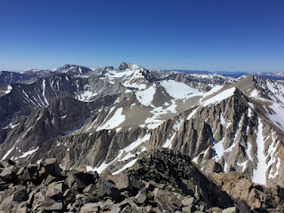
Mt Williamson 14,380 feet is the second highest mountain in both the Sierra Nevada range and the state of California. It's much harder than Whitney and have been on my to do list for quite some time. The standard ascent route is from the west side via Shepherd's Pass, involving 10,500 ft of elevation gain and 27 miles round trip. With top of the mountain still covered in snow we opted for direct and shorter route via North Fork of Bairs Creek, only 10 miles round trip, but there was no established trail in this area. Unfortunately, our car could not make it to trail head, crossing creek with deep swift water did not look very promising, which added another 2 miles each way.
We camped at 10,000 ft just below the snow line. There was no good camping spots at that altitude and we have to flatten and move rocks around to make some.
 |
| First glimpse of the route |
 |
| Bairs Creek |
 |
| Waterfalls |
 |
| Creek crossing |
 |
| Grand Cirque |
 |
| Flying off |
 |
| Mt. Williamson register |
 |
| Looking north |
 |
| Mt Tyndall |


No comments:
Post a Comment