Showing posts with label hike. Show all posts

Saturday, October 14, 2023

CEBOS loop hike

CEBOS is abbreviation for Cucamonga, Etiwanda, Bighorn, Ontario and Sugarloaf, not sure if anyone used that name before, but let's see if it will stick. I have done all of these peaks before except Sugarloaf and researching some of the longer trails online found that there is a 'path' connecting Ontario peak and Sugarloaf and descending back to Ice house canyon. I can't resist to check it out. 

CEBOS loop hike

Matching colors

View from Etiwanda peak


Ontario peak

Ridge

Sugarloaf peak (left)

Descent to Ice house canyon


Saturday, September 30, 2023

Villager Peak

Villager peak (5,755 ft) is located in the Santa Rosa Mountains in the Anza-Borrego State Park. It lies between Rabbit peak to the north and Rosa Point to the southeast. Bad rainy weather forced me to think out of the box and did a desert exploration mission. We was considering continue hiking to the Rabbit Peak, but it was way too windy and view was blear and not very impressive.


Rabbit Peak (right)

Trail following this ridge


Coyote Peak


Sunday, October 14, 2018

Iron Mountain hike

I have been hiking for a while in San Gabriel mountains and never heard about Iron Mt. but one of my co-workers mentioned that this is hardest hike in San Gabriel. Well, I was so curious I went to check it out next weekend. Hike statistics: 14 miles with 7200 ft elevation gain.
Mist in the morning
 We was very lucky with conditions, light rain and mist in the morning was perfect. Trail is following exposed ridge without much shade until almost the top where forest starts.

Spider web

Above the clouds

Sunrise

Iron Mt. register. Baldy behind.

Looking west from Iron Mt.


Resident lizard.


Giraffe

Sunday, August 12, 2018

Mineral King Loop, 3 days backpacking

Recent fires all over California made it quite difficult to choose backpacking destination. After all considerations we went to Mineral King in Sequoia National Park.
  • Day 1 - Hiked to Spring lake via Glacier pass.
  • Day 2 - Cyclamen lake -> Columbine lake -> Sawtooth pass -> Sawtooth Peak (12,343 ft) -> Crystal lake.
  • Day 3 - Hiked out
Good weather and only minimal smoke later in the day.

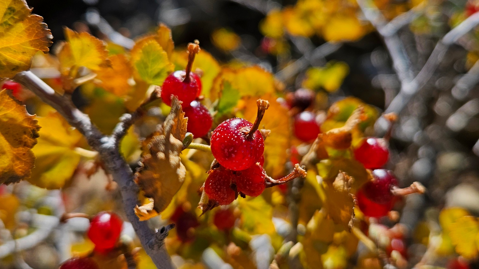
Wild currant

Glacier pass

Glacier pass looking east
 Down climbing from Glacier pass looks scary from the top, but not harder than class 3.
Descending from Glacier pass

Spring Lake

Trout
 Path to Columbine lake is from the left side of the picture just above the lake to the middle, you want to stay on the left side all the time.
We had an interesting event near top of Sawtooth Peak. I was trying to take a picture at the top when suddenly cloud of electricity materialized around my hand with phone. I was very lucky lightening did not strike. I turned phone off immediately and we went down as fast as we can.
Waiting in the cave for rain to pass

Near Sawtooth Peak

Sawtooth Peak

Upper Monarch Lake
Happy to go through the pass, we was not sure we can make it or not, not much information was available beforehand. Looking at easy descent to our last camping spot near Crystal lake.
Crystal Lake

Tuesday, July 7, 2009

Mt Whitney day hike

Mount Whitney is the highest summit in the contiguous United States with an elevation of 14,505 feet (4,421 m). Its a 22 miles (35 km) round trip with an elevation gain of over 6,100 feet (1,900 m) from Whitney Portal. You have to apply to the Mt. Whitney Lottery in February to reserve a wilderness permit for summer hike. I was lucky to win permit for Sunday July 5th.

We arrived to Lone Pine at Friday to get actual permit and some acclimatization before hike. Spent night in Horseshoe Meadow, elevation 10000 feet (3,048 m) and hiked to Cottonwood lakes at Saturday. Then moved to Whitney Portal, elevation 8,360 feet (2,550 m) to get some sleep before long day. I want to have some extra hours just in case things will go slow. So, we started our journey at 1:30 am. We catch the sunrise near Trail Camp, 12000 ft (3,657 m).
Looking back to Trail Camp and Consolation Lake from switchbacks

Acclimatization helped me and Ivan a lot. I did slow down just after Trail Camp, but in the middle of switchbacks regained my normal speed. Our third companion Igor refused from acclimatization and arrived to trailhead just before hike, which cost him a lot of time to deal with hypoxia and finally he was short of summit by few miles.
Arriving at Trail Crest

Looking to Hitchcock Lakes from Trail Crest

In the middle of Trail Crest looking back

From this point trail is quite flat and walking is easier. I noticed that following somebody I can move much faster then walking by myself. Ivan was ahead of me and arrived to summit about 15 minutes earlier, Igor was behind and did not made summit.
View from the summit toward Lone Pine

Looking south from the summit

It took me 10 hours to reach summit. I rest for awhile, sign the register, take photos and we start our way back at 12:00 pm. Going down is always easy, but still it was long long way back. At least we could enjoy by beautiful lakes and meadows, which we did not saw on the way up.
Trailside meadow

Mirror Lake

We was back at trailhead at 7:40 pm (17:10 total hike time) and back home at 1 am. In terms of equipment the most important are comfortable boots, jacket to protect from wind and cold, headlamp and water. I used 2.5 litters of water, 2 apples and 5 powerbars. This is my longest and highest hike so far.

Sunday, October 19, 2008

Mt. Baden Powell hike

После Mt. San Antonio подъем на Baden Powell показался полной халявой. Перепад высоты 925 метров. Трейл начинается на пересечении хайвея №2 и Big Rock Creek Rd (34.374, -117.752), но заехать можно только со стороны пустыни Мохаве, так как участок дороги в другую сторону ремонтируется вот уже несколько лет. Так как это северная сторона подниматься довольно комфортно, практически весь подъем проходит через сосновый бор, так же создающий тень.

Забавный случай произошел со мной по пути к началу трейла. Забив в GPS (Tom Tom) координаты старта я полностью положился на него, не вдаваясь в детали маршрута. Поверните на лево, поверните на право, но неожиданно дорога оказалась перекрыта шлагбаумом со знаком стоп. Несколько удивившись, я припарковался на Visitors Parking и заметив огни, внутри какого-то административного здания смело открыл дверь с табличкой Visitors. Я честно думал, что это домик лесников, где за большим столом сидело человек 8 в оранжевых робах и еще несколько человек им что-то объясняли. Один из объяснявших вывел меня обратно на улицу, где я поинтересовался, как же проехать к Baden Powell. Он объяснил, где именно я пропустил очередной поворот. Тут появился новый персонаж, мент хорошо так вооруженный и заспанный с удивлением посмотрел на меня. Мой собеседник объяснил, что я турист и тупо заблудился. И тут задав коронный вопрос, не продается ли у них "пропуск в лес", который мне надо было купить, мне, наконец, объяснили, куда я попал, это оказалась тюрьма и никаких билетов там естественно не продавалось. Тут до меня дошло, кто были эти люди в оранжевых робах. Убравшись восвояси, я долго и с презрением смотрел на GPS, борясь с желанием разбить его чем-нибудь тяжелым. Но на воротах красовалась довольно крупная надпись про тюрьму, так что GPS я в итоге простил и поехал в объезд к началу трейла.


Маршрут начал в 7:52 и уже в 10:10 был на пике. По дороге встретил оленя и несколько белок, а на обкатном пути других туристов. Фотки: