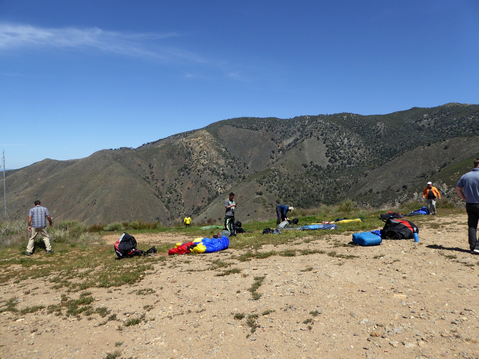
Showing posts with label XC. Show all posts

Sunday, October 3, 2021

Marshall to Lancaster flight, 67 miles

 Another high cloud base day with SE wind and typical course. I was flying with Gavin, Rush, Jai Pal and Jonathan. Days in October are short and we was late at least 30 minutes, I was able to climb to 6K just right after the launch and start the journey to NW. Flight was good until I get to Palmdale area and decided to experiment with the line, going to the east low ridge. Bad idea. I should stay with Russ on the left (west) side. Russ was able to fly all the way to Quail Lake.

First pilot

Silverwood Lake

Climbing with Jonathan, I-15 behind.

Lake Palmdale


LZ was not particularly friendly

Gavin, Russ & Jai Pal
My GPS track:

Friday, October 1, 2021

Elsinore to Corona and back flight, 35 miles

 I flew from Lake Elsinore to past Corona before, but this time idea was to do out and return and maybe try to shoot toward Soboba. Dmitry was up for a challenge and we had an excellent flight to south Corona and back. We could probably fly all the way to the end of the mountain ridge, but commercial airplanes traffic was so bad we decided to play it safe and turn around early. Well, not early enough to have a chance for Soboba leg, since sea breeze already arrived when we returned to Elsinore. Dmitry laded on the lake shore and I attempted to cross the lake and establish on the other side, but that did not quite work out. I landed maybe 10 miles up near hw 74, but still managed to do a nice 57 km free triangle.

Lake Elsinore Launch

Lake Elsinore

Santiago Peak

My LZ
My GPS track:

Saturday, September 11, 2021

Blackhawk to Baker flight, 103 miles

 I think I was at Blackhawk launch at least 2 or 3 times, but never flew from there due to strong winds, but this year Gavin convinced me that it's going to be fine. There was also few folks from SB and Nicole was our driver. In fact conditions was excellent, light breeze with some cumulus clouds popping up near launch. As much as I had bad luck with this launch before this flight felt like jackpot and completely changed my perspective about it. Most of my desert flying before was from Marshall/Crestline on easterly days toward Palmdale and there was 1 occasion when we flew Kagel to Barstow. There are certainly more days when Marshall and Kagel does not work due to inversion and launching from desert (Ord and Blackhawk) makes a huge difference, but wind prediction is something I have to work on to avoid wasting time to come on the days when it's too strong.

Blackhawk

Ozone M7

Blackhawk and hw 18

On the north side of hw 40

Afton Canyon

Mountains on the west side of hw 127

Picking LZ along I-15

Sunset

My LZ
My GPS track:

Sunday, March 28, 2021

Marshall to Little San G. and back flight, 53 miles

Spring is one of the best times for XC flights. We had a good crew for a day and was able to fly to Little San Gorgonio and back with Reavis.

Tom

Gavin

Reavis

San Gorgonio

On glide with Reavis


Andy Jackson LZ

My flight:

https://www.paraglidingforum.com/leonardo/flight/2747355


Sunday, July 14, 2019

US Paragliding Nationals, Chelan 2019

Not much flying for me last 2 years, so my goal was to get out and flew as much as I can and competitions, especially Chelan is perfect for this. I stopped and flew Herd Peak near Shasta Mt. on my way there.
Herd Peak
We had 5 tasks out of 7 days, 124 pilots participated, overall I took 76th place. Results are here. I made goal twice in the first and last tasks, not great for the score, but overall I was satisfied with ~25 hours of airtime. Competition level was definitely higher than last time I flew in Chelan, more pilots was making goal and faster too. In the Sport class 12 pilots had better results than me on the D wing.
Russian team

Chelan launch

Start

Chelan lake

Crossing river

Over the launch


LZ

Sunday, April 22, 2018

Palomar to Anza flight, 32 miles

Forecast looked pretty decent for Marshall and Laguna. Concern for Marshall was late switch from north and NE wind after San Gorgonio Mountain. There was nice convergence along I-10 and Joshua Tree after that. For Laguna surface wind looked a bit strong in the morning, but supposed to get lighter by afternoon and there was also light head north wind at the top of the life.

I picked Laguna just because it's been a while when I flew there. Wrong choice! it was blowing 20 mph gusting to 25 in a morning and we end up flying Palomar instead. This was my second time flying Palomar and first time going over the back. Dmitry outlined a pretty straight forward plan, go to observatory, get high, move to the back ridge, get high and so on.

Palomar launch

Pilots getting ready at Palomar
We launched around 12:00 into very nice conditions and went to 6K right away, but wind at launch switched to catabatic, so half of our group have to wait 20 min before they joined us. Base get higher and after good climb near launch to 7K we moved up a spine and got another climb to 8K, but instead of going to observatory we all split for unknown reason. Phil and Dmitry went west, other pilots east along the ridge and I just stayed in the same area.
Phil on Zeno
On glide to observatory
There was high clouds moving in, thin enough, but still reducing heating and thermal strength. After one more climb to 9K I glided toward observatory. Wind was around 5-10 mph from the north, so I have to fly up wind. As Dmitry predicted there was good thermal waiting for me at observatory. Climbed to 10.5K and went to north ridge chasing sailplanes. There was at least 3 or 4 of them marking thermals along the ridge. It's always intimidating to stay in the same themal with them. I can even see pilot was flying by and taking picture of me!
Sailplane
There was broken convergence marked by small pieces of clouds to the north, so I just try to stay as close to convergence as possible. It was quite turbulent in some places, got a full frontal at one point, ouch. By the time I came to Anza convergence fell apart and thermals was small and nasty. I did not want to push low into foothills and landed into strong 15 mph west wind.

Thanks a lot to Bill and Carolyn for picking me up, no one else flew OTB.

http://www.paraglidingforum.com/leonardo/flight/1937941


Saturday, April 14, 2018

Marshall to Keller to San B. and back flight, 57 miles

CSS-750 Launch
Forecast was for 7-8K day with fast north to SW switch, not epic, plus I had a time constraints and have to be home by 6ish, so was not even sure I was going to fly until last minute. Aaron was running XC League with task Marshall->Cajon->Barstow and open distance along I-15 after. I was not very inspired to join because:

  1. North wind in afternoon could put you on the ground early. West supposed to kick-in much later in the day.
  2. 9K cloud base was way too low for desert, I prefer to have at least 12K+.
  3. Blue day (no clouds), harder to find thermals and as result slower speed.
  4. Potentially long retrieve.

Have to drop my son to school in AM and only made it to LZ by 11:00. XC League already left and next shuttle was scheduled at 12:30, so I just hiked to 750 launch. Task start was at 12:10 and I wanted to join them at least for the first leg to Cajon. Almost made it in time, launched at 12:16 and found a climb right away, was maybe 10 min behind main gaggle. Climbed to 8K behind Pine Mt and flew to next peak after Sugar Pine. Watched pilots leaving OTB with OK altitude, but decided not to go myself (as planned), turned around and was hoping to fly at least to Keller and back.
Lake Arrowhead
I was at Keller by 2:35, so enough time to cross toward San Gorgonio. It's very spectacular and intimidating line, which I flew before. There are landings in the canyon, but hike out is at least 2-3 hours, not an option considering my time constrains, so I was a bit nervous even though start crossing from 10.7K.
Keller Peak (left) San Gorgonio (right)
Got a broken thermal at Constance Peak, but did not spend long time there and pushed to main ridge, worked my way up and eventually topped out at 10.9K at 3:25 and turned around. Since forecast was calling for relatively strong west later in the day, I did not have much expectations about return flight, but still want to push at least to Harrison to minimize Uber time and cost. Climbed back to 7K at Harrison and keep pushing back, mostly on 2/3 of speed bar. There was only 1 or 2 HG over Marshall, typically sign of strong wind, which in fact was quite strong. Took me awhile to land, could not find any sink near LZ. Finally landed at Andy Jackson at 4:58.
Andy Jackson LZ
My track: http://www.paraglidingforum.com/leonardo/flight/1928952

Russ landed in Hesperia, most of the other pilots in Victorville, Aaron managed to fly 100 km past Barstow.

Sunday, March 18, 2018

Kagel to Marshall flight, 62 miles

Haytham ready to launch from Kagel
Post-frontal day with plenty of clouds, but a bit low cloud base round 6-7K most of the day. My wife offered to drop me off at beginning of unpaved road, so I can launch early and simplify retrieve. My PG friends from San Francisco Dmitry and Vladimir as well as Haytham joined me. We can't all fit into Prius, so Haytham have to hike from LZ, which he did even faster.

On glide from Kagel
Launched at 12:02 into light cycles and have to wait for 20 minutes for weather to develop. I jumped from cloud to cloud and even though base was ~5K no issues until Big T. Typically Big T works great, but today it didn't produce much and I have to stay and search for a lift. After Lukens got to 6.5K and even higher than nearby cloud.
Above the cloud near Lukens
Next section from Brown Mount to Monrovia Peak typically very fast and easy flight was super slow this time because of shade and enormous clouds with base lower than Mt. Wilson. After Monrovia it was all sunny again. Contrary with typical struggle in these low foothills after Azusa there was plenty of clouds mapping tops of the thermals.

Last challenge was crossing Cajon pass. Cucamonga peak was obscured by clouds and I only can get to 6.7K, which made crossing very interesting. There was also not much of a typical west tail wind. I get some bumps near 15 & 215 highways intersection down at 3000 ft (1000 ft AGL). Staying in bubbles I slowly drifted into the mountains working my way up. When low it's the best strategy to stay even in zero lift and wait for next pulse. 5.5K was more than enough for final glide into Andy Jackson LZ.
Marshall LZ
What's interesting about this flight is that I never get above 7K, so such flight is possible on a low base days, but speed would not be very fast. Thanks a lot to Frank for giving me a ride back to home!

http://www.paraglidingforum.com/leonardo/flight/1903673

Sunday, September 3, 2017

Walt's Point to Mammoth Lakes flight, 90 miles

After our spring flights I was very comfortable to fly deep over the Palisades and fall didn't disappointed. In the beginning of the flight I was finally able to fly right over Mt. Whitney with Gavin performing awesome wind overs in front of the peak.
Mt. Whitney

Tulainyo Lake
After Big Pine we flew deep into Palisades, but after Mt. Tom we split. Gavin went straight over Wheeler crest toward Mt. Morgan and I stayed over Wheeler crest eventually landing  just before Mammoth lakes. Gavin flew straight line and was able to make it almost to Lee Vining.
Sierra Nevada Mountains

Landing near Mammoth Lakes
 And here is video
Tracks:
My: http://www.paraglidingforum.com/leonardo/flight/1709503
Gavin: https://www.xcontest.org/2017/usa/flights/detail:gavatron/2.09.2017/18:20