Thursday, July 1, 2021

Mt. Muir

Map

Mt. Muir was last California 14ers for me to complete. It's located in Whitey Zone and requires permit. We even got an overnight permit for Whitey for end of June, but due to fire it was canceled, so I have to do some improvisation. Instead of direct route I decided to start from Meysan Lakes and do loop with few bonus peaks.


Foothills after recent fire


Meadow near Meson Lake


Between rock and ice


Mt Mallory

Bivi spot at 13,000 ft

Mt. Irvine

Sunset

Mt. Langley

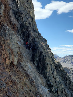
After sleeping at 13'000 ft. my first peak was Mt. Mallory. Initially I try to traverse on the west side, but stuck at sketchy down climb and have to go all the way back and hike 150 ft down and use one the chutes to went up, which worked out. On the way back I use the path where I stuck in the morning, since going up was much easier.


Mt. Irvine was easy, there was some interesting sections going down toward Arc pass, but nothing memorable.
Chimney

My 3rd objective was Mt. McAdie, but I run of water and have to detour to unnamed lake to refill and come back to Arc Pass. It was getting late in the day and I decided to leave McAdie for next time and descended via Arc Pass to Consultation Lake.

Mt. McAdie

Sky Blue Lake

After spending second night at Consultation Lake I continued via easy trail to my main objective. It was easy 30-40 min scramble to tag Mt. Muir.

Hitchcock Lakes

Mt. Muir

Mt. Whitney

Opted to descent via Mountaineering route, which was fast and convenient. The only surprise was impassable waterfall in the main canyon, so I have to south to avoid it.

Sunday, June 27, 2021

White Mountain Peak

 White Mountain Peak, at 14,252-foot, is the highest peak in the White Mountains facing the Sierra Nevada across the upper Owens Valley. Long unpaved road leads to gate seven miles from the summit at an elevation of 11,680 ft, making this California's easiest 14,000 ft summit.


Saturday, June 26, 2021

Middle Palisades

 Middle Palisade 14'018 ft. is a peak in the Palisades group, part of the central Sierra Nevada mountain range. I tried to do it just a week ago, but have to turn back because of rain and sketchy conditions. Knowing approach and start of the route definitely speed up the ascent. We did it as a long day hike. Another fourteener completed.


Middle Palisade


Saturday, June 19, 2021

Mt. Sill

 Mount Sill 14,159 ft. is one of the fourteeners of the Sierra Nevada in California. It is located in the Palisades, a group of striking rock peaks with a few small glaciers on their flanks. Last year we try to do Thunderbolt to Sill Traverse, but have to cut it short because of my headache. This year we was back, but from the different direction. I was camping at Brainerd Lake for previous few days, definitely not recommend as it's probably a capitol of entire mosquito population of High Sierra.

Willow Lake
I did not want to go all the way down to South Fork Big Pine Creek and decide to traverse high, which was very challenging and slow. Connected with the creek just before the fork to Elinor Lake.


Mt. Sill

Haytham


Mt. Sill view from the top. N. Palisades


Cat walk


The best part of expedition