Monday, July 8, 2013

High Sierra Trail, 5 days backpacking

Map for Google Earth with waypoints: HighSierraTrail.kmz

Printable maps, based on closedcontour with highlighted trail:
High Sierra Trail Map. Part 1
High Sierra Trail Map. Part 2
Logistics was quite complicated because the start and end trailheads are 280 miles apart. My plan was to take overnight bus to trailhead and one of my friends offered to pick me up on the way back. Evgeniy pick me up at 11:30 pm and we were at Greyhound bus station at midnight. I bought tickets online, so just need to register my backpack (30 lb). Bus to Visalia was late arriving at 6:00 am, but I still had another 20 minutes to spare before next bus to Sequoia Park. It was easy to recognize this bus with park's logo. On the website they say that bus only goes to Museum, but since it was first bus and there was few park employees we drove all the way to Lodgepole, exactly where I need to get my wilderness permit. Buses inside the Park start operating at 9:00, so I had some time for breakfast. Then another 2 buses to Museum and then to Crescent Meadow and at 10:00 I was ready for adventure.
Crescent Meadow. High Sierra Trail start
Day 1. Crescent Meadow to Big Hamilton Lake, 16 miles
First miles are not very spectacular. Trail goes on the canyon's side with big mountains far, far away. It passes below Panther Gap and then Alta Peak on the right side.
High Sierra Trail beginning
There are few camp sites with bear boxes: Mehrten Creek, Nine Mile Creek but they're small and not worth stopping. Bearpaw Meadow is the first place where view improves significantly and could be considered for spending a night, but I continue.
Bearpaw Meadow
Kaweah Gap
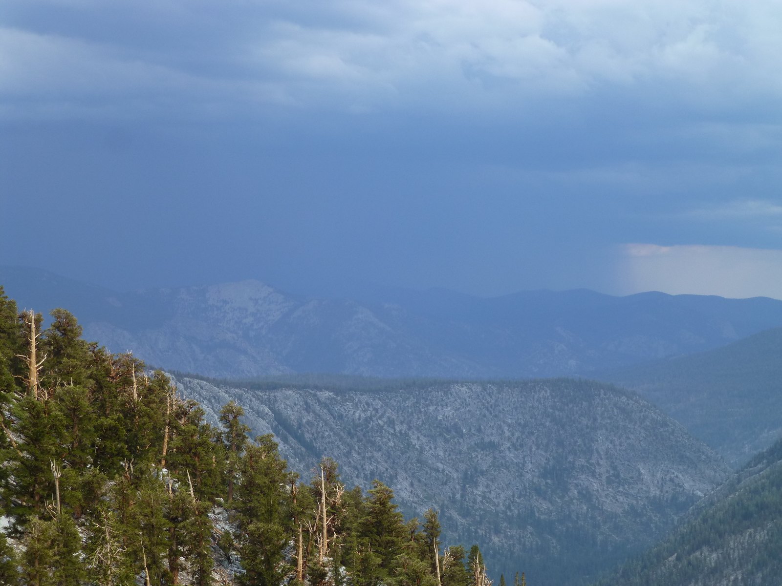
Rain catch me at Lone Pine Creek and I first decided to camp there and set up my tent, but after an hour skies cleared up and I still have 2 hours to make it to Big Hamilton Lake, which I did. Lake was gorgeous, one of the best I ever saw in Sierra.
Big Hamilton Lake
First day after sleepless night and 10 hours on the trail was the most difficult on this trip. Hiking time 8:40, elevation gain 3700 ft.

Day 2. Big Hamilton Lake to Moraine Lake, 14 miles
I woke up at 7:00, had a quick breakfast and on the trail by 8:00. Going over Kaweah Gap was slow. Spectacular view, which become better and better was a main reason to slow down.
Coming to Kaweah Gap
Precipice Lake
After gap trail goes down into Big Arroyo canyon and then climbs up again on to Chagoopa Plateau.
Big Arroyo canyon
That's where I run into another rain and hail. I was lucky to find small cave, to hide from the rain and after 1 hour of waiting continue east.
Hiding from the rain and hail
Hail melting on the trail
Second rain catch me on the plateau and I spend another hour under the tree.
Rain in Sierra
Waiting under the tree, Chagoopa Plateau
It was pretty wet everywhere from melting hail and rain. Finally, I made it to Moraine Lake to be the only one to camp there.
Morain Lake
It was not comfortable to camp on the wet ground and all my clothes were wet as well. At least I had second set of dry clothes. Hiking time 8:30, elevation gain 3500 ft.

Day 3. Moraine Lake to Junction Meadow, 14 miles
I had a similar timing today 7:00 up and on the trail by 8:00. Weather supposed to improve today with only slight chance of thunderstorms, which never materialized and I had easy, mostly flat section going north in Kern canyon.
Kern Canyon looking south
Another pleasant feature of the day was Kern Hot Springs. Actually, they were too hot, so I have to wait for 10 minutes before I can get in. Since Hot Springs located on the river bank I made few round trips between springs and Kern River with ice cold water. It felt almost like Russian bath in the winter.
Kern Hot Springs
Gooseberry
Junction Meadow was my next camping spot. There was no one there again, except mosquitoes.
Junction Meadow
Kern River
Since there was no rain in forecast for the night I did not set rain-fly and enjoyed stars from the tent.
Hiding from mosquitoes in the tent
Hiking time 7:30, elevation gain 1500 ft.

Day 4. Junction Meadow to Guitar Lake, 12 miles
I woke up at 6:00. Despite low elevation, 8000 ft, it was cold night, hard to imagine how cold it will be at Guitar Lake at 11500 ft. Start hiking at 7:00 and was at Guitar Lake by 2:00 pm already, so I can finish the trail in 4 days if I want to.
Camping at Guitar Lake
After I set up my tent I went for evening hike to Hitchcock Lakes.
Hitchcock Lakes
There were about 6 other hikers camping at Guitar Lake, first time I was camping with someone else after Hamilton Lakes. Hiking time 7:00, elevation gain 4100 ft.

Day 5. Guitar Lake to Whitney Portal, 15 miles
I woke up at 4:00, skipped breakfast and start hiking at 4:30. I was too conservative about my estimations and was way ahead of schedule.
Hitchcock Lakes at sunrise
Just 2 hours to Trail Crest and another hour to Whitney. Surprisingly there was AT&T cell phone reception on the top, so I can check my emails for last 5 days, pretty weird place to work.
On Whitney
After endless switchbacks to Consultation Lake
Switchbacks on Whitney trail
I finished hike at Whitney Portal at 2:00 pm. Hiking time 9:00, elevation gain 3200 ft, loss 6400 ft.
Whitney Portal
Trail statistics:
Total elevation gain official: 18000 ft (according to my GPS: 16300 ft)
Total distance official: 72 miles (according to my GPS: 62 miles)
Total hiking time: 41 hours

Sunday, June 30, 2013

Mineral King Loop, 2 days backpacking

Route: Mineral King -> Glacier Pass -> Spring Lake -> Cyclamen Lake -> Columbine Lake -> Sawtooth Pass -> Sawtooth Peak -> Mineral King
Hiking Mineral King loop map
I need to check all my gear before High Sierra Trail, so decided to do this easy loop as 2 days hike.
Sawtooth peak on the left
There is a non maintained (old) trail on the left side of the valley, very easy to follow up to the Glacier Pass.
North side of Glacier Pass
There was still little bit of snow on the other side, but easy passable.
Spring Lake and route to Columbine Lake
I camped near Spring Lake, which was a right choice, slightly lower elevation, more beautiful, some trees around. I was worried about next part of the route, especially from Cyclamen to Columbine Lake. In Google Earth it looked way too steep, but turned out to be ok.
Cyclamen Lake and Spring Lake
Sawtooth Peak from Columbine Lake
At this point I reconnect with established trail again, easy going to Sawtooth Pass.
Sawtooth Peak from the Sawtooth Pass
One mile traverse to peak was slow and took 1:30 there and 1:00 back. Its quite sandy, last few blocks before the peak require some climbing, but not too bad. Here is views from the top:
Monarch Lakes from Sawtooth Peak

Columbine Lake from Sawtooth Peak

Sawtooth Pass from Sawtooth Peak

Going down was fast. Official trail goes way to the west, but looks like most of people just going straight down, sliding on sand, took me just 40 minutes to reach lower Monarch Lake and good trail from there back to the car. Marmots was generous enough not to eat my car during my absence.

Sunday, June 23, 2013

Epic day hike in Minarets

I did a Mt. Ritter last year and like it a lot, so I come back and check out some more lakes. Here is a map of my route:
Superior Minaret Cecile Iceberg Ediza Shadow lakes loop map
I started at 6:00 from Devil's postpile trail head. Beginning of the trail was not quite spectacular, but at least mostly in the forest and well shaded. View starting to get better after intersection with Fern Lakes trail where you can see Iron Mountain and adjacent valleys. I made Superior lake by 9:00. Eat my breakfast (25 min) while thinking of the best route over the ridge.
Superior lake
That's where fun part begins. Nancy Pass is just in the middle of this picture, easy class 2, but still took me about an hour to get on the top. 10:25.
Looking north from Nancy Pass. Minaret lake in the distance.
Going down was not fast either. I saw a big bear (very light brown color) maybe 100 meters down the ridge. He look at me for 10 seconds, but as soon as I start getting my camera turn around and run away. Next valley was still flooded, so main challenge was to find dry route, which was successfully accomplished. I made Minaret lake by 12:40.
Minaret lake
West shore was still covered with snow, but pretty soft at this time of the day. Finally I reconnect with the existing trail on the north side of the lake, no more cross country I was thinking, mistake, big mistake.
Looking back to Minaret lake
Cecile lake
East side still covered with snow, but I was able to come around this time. However worst snow crossing was still ahead.
Iceberg lake
Iceberg lake covered with snow
It was 2:20 pm still enough time to complete the route, so I took it slowly and carefully making each step, did not want to swim in the cold water, at least in the clothes.
Ediza lake with Mt. Ritter and Banner peak in background
Ediza lake 3:40 pm from there it was a matter of patience, the most interesting parts was behind and view started to degrade with several exceptions such as flowers and small water falls in Shadow creek. Exit via Shadow creek was much more beautiful that enter via Beck lake trail.
Flowers Shadow creek
Mammoth Mt.
Back to the car by 8:20 pm, 14:20 total time and about 20 miles on the trail, long, but very satisfying day hike. Back home at 2:00 am.

Saturday, June 22, 2013

Clouds Rest from Tenaya Lake hike in Yosemite

Another Owens weekend is left behind. Friday night I camped in Alabama Hills and hoped for some flying at Saturday in particular from 9-Miles or Walt's point, but Saturday's morning forecast indicated some north wind, which is not good. Dave & Co. was flying from Bazooka ridge near Mono lake, but its 2 hours drive from Lone Pine and I was more interested in out and return from the Flynns. Hiked to Flynn's just by myself, it took me about 1.5 hours. Launched at 12:00, but probably too early, scratched in the bubbles for 15 minutes and landed next to my car. Oh well, not the best day of flying, but at least I went out there and try. You would never get a great flight sitting at home and finding excuses not to go. Since it was only 12:00 I decided to check out Clouds Rest peak in Yosemite, its 15 miles round trip with only 600 m (or so) elevation gain, pretty flat in my opinion. It took me 2:30 up and 2:15 down, 4:45 total time. View is indeed awesome, reminded me of Angles Landing in Zion, but on the larger scale. Here is few pictures:
Meadow near Tenaya Lake
Half Dome from the Clouds Rest
Looking south-east from Clouds Rest
Looking north-east from Clouds Rest. Tenaya Lake in the distance.

Saturday, June 8, 2013

McGee to Lee Vining flight, 32 miles

There was few pilots looking for the big flight from 9-Mile this weekend, but weather did not cooperate with mostly east wind and north after Boundary peak. Since big flight was not in the cards I decided to do some exploration to the north of Bishop and joined Kia, Will and Dave who was camping at Rock Creek Lake campground with a big group of climbers. We launched from McGee:
McGee paragliding launch
Launch is small grassy hillside just below the road, you need to sort all the gear on the road, so strong cycles does not pick up your wing. I launched at 11:05 right after Dave. Original plan was to fly south toward Bishop, but wind was already from south east, so after we established above McGee we headed north west toward Mammoth Lakes. Will and Kia flew locally. Big thanks to Nadia (Kia's friend) for driving the car from the launch. After Mammoth Lakes there is a 10 miles "no landing" section until June lake. Dave was leading and reporting some head wind over this section and potential of top landing and long hike out, but this is his home site and he was confident. On another hand it was my first flight in this area and I had no idea where nearest roads may be if I land out. I try my best to gain some altitude over Mammoth Mountain and it was only 13K with surface altitude around 9-10K, so I bailed and decided to fly around. "Flats" covered with forest as well, but there're few landable fields along highway 395. It took awhile to push upwind toward 395, but when I got there things improved significantly. I finally got to the cloud base at almost 17K and was coursing at 70 km/h with nice tail wind. Dave made it through the tough section and landed near Grant lake. I enjoyed the view of Mono lake during a long flats crossing toward the Lee Vining. I had an option to cross slightly more to the west to connect with mountains sooner, but it was a longer route and I choose direct line. I did not get any good thermals near Lee Vining and wind changed to north east, so I landed at the small airport. All the crew was there already waiting for me.
http://www.paraglidingforum.com/leonardo/flight/764968

After lunch we went for glass off flight from Bazooka (also called Lee Vining on Leonardo). Excellent grassy launch overseeing Mono lake. Here is Dave soaring on his Ice Peak 6:
Bazooka (Lee Vining) paragliding launch
We try to fly back, wind was already from the north, but flight was only 30 minutes, pretty mellow conditions. We did not even get over the ridge. Kia and Will landed at the airport. Dave attempted to jump back to the mountains where most of the clouds was with some starting to overdevelop and I try slightly more front line, but we both landed near Grant lake.
Clouds over Grant lake
Waiting for retrieve on highway 158

Saturday, June 1, 2013

Marshall to Keller and back flight, 29 miles

Interesting day, pretty late start almost at 2:00 pm, strong wind at Marshall, took me few attempts to get off launch and then it feels too windy for XC, so I headed toward Cloud then over 750 took a good climb to 8K and there was almost no drift during the climb, which means that all wind down low was thermal induced. Flew toward Strawberry peak and high school, but surprisingly no thermals, so I have to bail out to 330 where I eventually get a next thermal back to 7K, which was enough to glide to Running Springs, get to 10K there and 12.8K over Keller peak. It was already 4:00 pm at that time and I was not confident I have enough time to join Owen over San Gorgonio (he climbed to 16K out there) and still make it back, so I turn around and glide back whole way to Marshall with nice tail wind.

My track log: http://paraglidingforum.com/leonardo/flight/760244

Friday, May 31, 2013

US Paragliding Nationals, Dunlap 2013


Its second time Dunlap, CA host the USA PG National Championship. However with questionable organizer I was one of many struggling with decision to go or not to go. Alternative comp was Rat Race. Dunlap advantages it was cheaper $375 versus $495 and closer only 4 hours drive versus 12, but it was unclear until 1 week before the comp who will participate. It was only 31 pilots for nationals, which is shame, but all major players was there Josh, Eric, Dean, Arnie, so I join them as well. Second question after participants is weather. You don't want to take vacation and sit whole week in rain and Dunlap did not disappointed 7 out of 7 flyable days. Here is analyze of my performance day by day:

Task 1. 49917 (3K exit)->OROSI->JESSE(5K)->LONNIE 58 km.
Good start, flying via Bald Mt. and normal route, but a bit slower then necessary. I struggled at OROSI turn point tagging it low and drifting back to the mountains. Some pilots went over flats, but result mostly depended on timing and if you was late thermals was weak and head wind was strong, so I landed one ridge behind 63LZ with Mitch and Bill. 40 km out of 58 and 11th place, 504 points for the day.

Task 2. 49917 (3K exit)->OROSI (13K)->PORAPT 81 km
After first task mostly by myself I decided to try to stay with lead gaggle no matter which route they took. Sure enough they choose shortest route via GRNY and Drum valley. Performance of Ozone M4 is not even close to modern 2-liners such as Niviuk IP6 or Boom 9 and after each glide I was lower and lower, but at least I made it to highway 245 over no man lands. 1 hour struggle to get high did not work out and I have to land. 24 km out of 81 and 21th place, 185 points for the day.

Task 3. DNLNCH (2K exit)->LONNIE(2K)->WDLKAP 48 km
Weather was not great, so short task to Woodlake was called. After gliding with lead gaggle to ranger station I  realized that landing is imminent if I continue, so I turn around and fly back toward 49917 utilizing any zero sink and bubbles eventually climbing back to 6K and follow second gaggle to Bold Mt. Many top pilots from the lead gaggle landed including Dean, Brett and Nicole. Rest of the flight was uneventful landing in goal at 2:56 just 30 minutes past Kansas who was first in goal. I was 7th with 671 points for the day.

Task 4. DNLNCH (1K exit)->ORANGE (1K)->CUTLER (1K)->WDLKAP 55 km
It was windy post frontal day with nice clouds in the beginning but once again GRNY route was challenging. Could not making it and fly back down wind toward Dan's LZ climbing back to 6K or so. Another attempt this time successful but still can't go anywhere so bailed back to NONAME waypoint with decent climb back there. 3rd attempt was not any different with few pilots landing at AIRSTRIP I don't want to wait for retrieve and flew back toward community center. 5 km out of 54 and only 2 pilots in goal. 14th place, 131 points for the day.

Task 5. DELILA (4K exit)->BALDMT->EXA10A->PORAPT 90 km
I was flying with lead gaggle until Tucker Mt. where they had just enough altitude and I can't make it round the top. It took me probably 20 min. to ridge soar and wait for decent thermal before I can get up and continue. Never the less I escapade and continue arriving at goal just 1 hour later than winner Brad Gunnuscio. Great day with cloud streets I can easily continue with another 30-40 km to finish the day, but don't want to mess with retrieve. 11th place, 596 points for the day.

Task 6. DNLNCH (3K exit)->OROSI(15K)->PK-APT 130 km
Longest task desperate marginal conditions with top of lift only 5-6K at best. I was so tired I had no patience at all landing just after Woodlake. Arnie took the same route via Bald Mt. and was only 5 km short of goal, so I can join him after we met at Tucker Mt., instead of flying by myself. Lead gaggle was flying mostly over the flats with 4 pilots in goal. I landed at the same field with Nicole and retrieve was there even before I packed my gear. 12th place, 316 points for the day.

Task 7. 49917 (3k exit)->DOLVES(1K)->SNDCRK (2K)->LONNIE 56  km
Eric was selling his IP6 so I took opportunity to test fly 2-liner. What a blast. It was so easy to stay with lead gaggle. I also had a chance to recover from 70% asymmetric collapse and it was much more dynamic then M4 or Venus with surge >90 degrees. Anyway conclusion is you must fly 2 liner if you want to win, there is no point to fly old EN D in the comps, but for hardcore XC such as Owens it may be too much especially down low. 5th place and 881 points for the day, arriving just 15 minutes behind Arnie who won the day.

Here is overall results, I managed to be number 10 out if 31, which is not bad considering quality of participants:
http://flyxc.org/dunlap2013.html